

The full 700 km crossing of the French Alps, broken into 11 days and seven bases. Seventeen passes, the Iseran and Galibier, Vauban's Briançon, the Mercantour, and a finish on the Riviera at Menton.
France has one road trip that is genuinely a crossing rather than a tour. The Route des Grandes Alpes runs about 700 km from Lake Geneva to the Mediterranean, linking seventeen named passes and climbing to 2,764 m at the Col de l'Iseran, the highest paved through-pass in the Alps. It was begun in 1909, opened in 1913 and fully surfaced by 1937, and it has been signposted as a single itinerary ever since.
The official version splits into four driving stages of roughly five hours each. That is doable, and plenty of people ride it that way on a motorbike, but five hours of hairpins is not the same as five hours of motorway and it leaves nothing in the tank for the places in between. This Route des Grandes Alpes road trip itinerary stretches the same road across 11 days and seven overnight bases, so each driving day runs one to three hours of real mountain road with an afternoon left over.
The route only exists as a through-drive when the high cols are clear of snow, which in practice means late June to early October. Opening dates shift every year. In 2026 the Col de la Bonette cleared in mid-May, while the Galibier and the Iseran did not open until around 12 June, and the Iseran can close again after a summer snowfall.
If you are travelling in the last week of June or the first week of October, check departmental road information before you commit to non-refundable bookings. Mid-July to mid-September is the safe window, at the cost of busier passes and higher room rates in the small villages.
A few practical points that shape the trip:
| Days | Base | Nights | What it covers |
|---|---|---|---|
| 1 | Thonon-les-Bains | 1 | Lake Geneva, arrival from Geneva |
| 2–3 | Bourg-Saint-Maurice | 2 | Aravis, Cormet de Roselend, Les Arcs |
| 4 | Valloire | 1 | Col de l'Iseran, Maurienne, Télégraphe |
| 5–6 | Briançon |
A 10-day southern France loop: Marseille's Calanques, Arles' Roman ruins and the Camargue, Saint-Tropez's beaches, and three nights on the French Riviera at Nice.
| 2 |
| Galibier, Cité Vauban, Vallée de la Clarée |
| 7–8 | Barcelonnette | 2 | Col d'Izoard, Col de Vars, the Ubaye |
| 9 | Saint-Martin-Vésubie | 1 | Col de la Bonette, Mercantour |
| 10–11 | Menton | 1 | Col de Turini, Sospel, the Riviera |
The plaque at Thonon marks the northern end of the route, on the French shore of Lake Geneva about 50 minutes from Geneva airport. One night is all it needs, and it is a gentle way to get over a flight before the driving starts.
Ride the funicular down to Port de Rives, which has been running since 1888 and was only the second built in France. The marina is the largest on the French side of the lake, and ferries run from it across to Yvoire. Above the town, Château de Ripaille is a 15th-century Savoy ducal residence that later became a charterhouse, with a 50 hectare estate and a working vineyard.
Collect your hire car on the French sector at Geneva if you can, which saves buying a Swiss motorway vignette you will never use again.
The first full driving day is the longest of the trip on paper and one of the best. The road climbs the Col des Gets into Morzine, where the mountains stop being foothills, then works south over the Col des Aravis and the Cormet de Roselend into the Tarentaise. Fill the tank in Cluses before you start: the Aravis and Roselend stretch runs well over an hour with almost nothing open.
Bourg-Saint-Maurice earns two nights because three Tour de France passes radiate from it and the town has the services you will not see again until Briançon. Use the spare day to drive the Cormet de Roselend properly, 19 km at around 6 per cent, then return over the narrower Col du Pré for the best view down onto the reservoir. If the weather turns, the funicular up to Les Arcs 1600 and Charlotte Perriand's 1960s ski architecture is a good indoor-ish alternative, and rafting on the Isère runs from the riverside base below town all summer.
Buy Beaufort cheese from the producers' cooperative shop while you are here. It travels well in a cool bag and it is the one edible souvenir of the drive.
This is the day people come for. From Bourg-Saint-Maurice the road climbs through Val-d'Isère and up the switchbacks to the Col de l'Iseran at 2,764 m, where there is a small chapel, a pass sign that everyone photographs, and a five-minute walk uphill that gets you a much better view than the car park does.
The descent into the Maurienne through Bonneval-sur-Arc is the finest half hour on the route: a listed stone-and-slate village, then a long run down the Arc valley. Turn south at Saint-Michel-de-Maurienne and climb the Col du Télégraphe to Valloire.
Valloire is a working village rather than a resort strip, tucked between the Télégraphe and the Galibier. The baroque church of Notre-Dame-de-l'Assomption, built between 1630 and 1682, has nine altarpieces and is one of the finest Savoyard interiors in the department. It is small, so book ahead in high summer.

Leave Valloire before 9am and you get the Col du Galibier, at 2,642 m, more or less to yourself. It drops to the Col du Lautaret and then runs down to Briançon in well under two hours of actual driving, which is why this leg looks short on a map and never feels it.
Briançon is the highest town in France and the cultural high point of the crossing. Vauban's bastioned upper town was built between 1692 and 1723 and has been UNESCO listed since 2008. Park below the Cité Vauban and walk up through the Porte de Pignerol, because the lanes inside are steep and largely pedestrian. The single-arch Pont d'Asfeld over the Durance gorge is worth the short walk out from the ramparts.
Use the second day for the Vallée de la Clarée, a classified natural site half an hour north that is best walked from Névache in the morning, or for the Grands Bains du Monêtier if your legs have had enough of passes. For dinner, Le Pêché Gourmand beside the Durance is a long-standing Michelin Guide listing at the foot of the old town.
The Col d'Izoard, 2,360 m, is the gateway from the Briançonnais into the Queyras, and just below the southern side sits the Casse Déserte: a field of pale scree and rock pinnacles that looks more lunar than alpine. There is a layby. Use it, rather than trying to photograph it while driving.
From Guillestre the road climbs the Col de Vars into the Ubaye and down to Barcelonnette, which is unlike anywhere else on the route. Locals who emigrated to Mexico in the 19th century came home wealthy and built villas here, and one of them, the Villa La Sapinière, now houses the Musée de la Vallée. The town still holds a Latin-Mexican festival every August.
Seven passes radiate from Barcelonnette. The temptation is to drive four of them. Pick two, ideally the Col de la Cayolle at 2,326 m for its narrow, quiet road, and keep an afternoon for the valley floor, the villas, or a rafting run on the Ubaye.
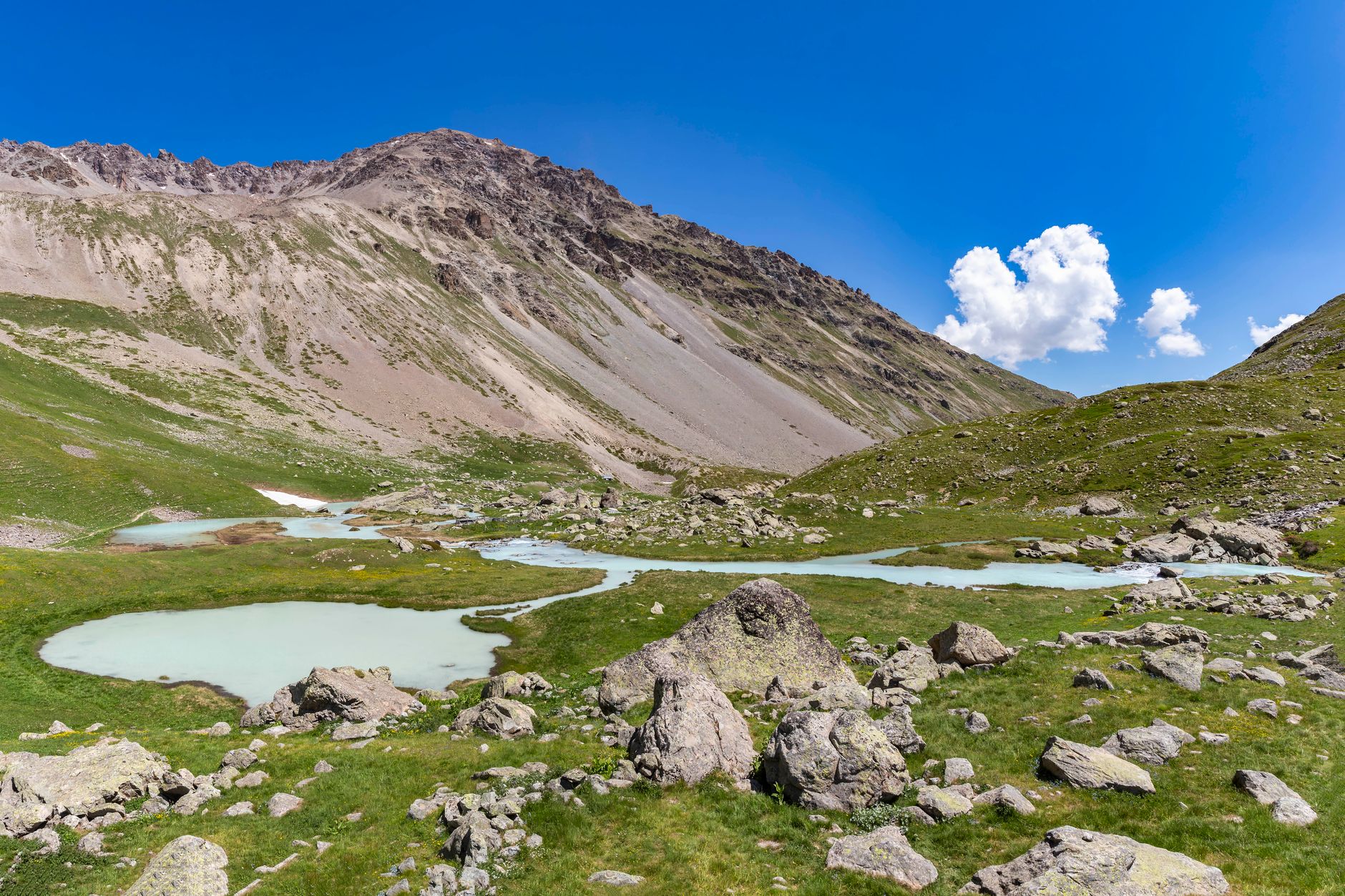
South from Jausiers the road climbs the Col de la Bonette, usually the first of the great passes to clear each spring. The short loop around the Cime de la Bonette takes you onto the highest surfaced road in France and costs only a few extra minutes.
The descent runs down the Tinée and over the Col Saint-Martin into the Vésubie. Saint-Martin-Vésubie is the Mercantour base: Parc Alpha at Le Boréon has kept wolf packs in large semi-free enclosures between 1,500 and 1,800 m since 2005, and the Madone de Fenestre valley behind town is where the serious walking starts.
One practical note. The Vésubie was devastated by Storm Alex in October 2020. The valley road has been rebuilt and is open, but reconstruction work continues into 2026 and beyond, so check departmental road notices the day before you drive it.
The last stage is short and completely different in character. The Col de Turini, familiar from the Monte Carlo Rally, climbs through chestnut forest and hairpins, then the road falls to Sospel and on to the coast. The alpine air becomes Mediterranean inside an hour.
Menton carries the official arrival plaque of the Route des Grandes Alpes, which is the proper place to finish. Walk up to the Basilique Saint-Michel-Archange and its black-and-white pebble-mosaic square, take an hour in the Jardin Serre de la Madone laid out by Lawrence Johnston between 1924 and 1939, and see the Musée Jean Cocteau in Rudy Ricciotti's seafront building. The Marché des Halles, an 1898 Belle Époque hall, is open mornings and quietest on a Monday.
Nice airport is 45 minutes west, which makes dropping a one-way hire car there far easier than retracing the passes.
If you only have a week, cut Thonon and start at Bourg-Saint-Maurice, and drop one of the two nights at Barcelonnette. You keep the Iseran, the Galibier, the Izoard and the Bonette, which is the core of the route.
If you have longer, add a night at Bonneval-sur-Arc or in the Queyras rather than lengthening the stays you already have. The route rewards more bases, not longer ones, because almost everything worth seeing sits on or just off the road itself.
This is a mid-budget trip. Mountain guesthouses and small hotels in Valloire, Barcelonnette and Saint-Martin-Vésubie are considerably cheaper than the Riviera night at the end, and campsites are plentiful if you are in a van. The driving is the real ask: high altitude, sustained hairpins and long descents that will heat your brakes if you ride them. Use low gears going down, take the passes early, and the Route des Grandes Alpes is one of the most rewarding drives in Europe rather than an endurance test.
A 10-day loop from Leeds through the Yorkshire Dales, Teesdale, UNESCO Durham and the chalk cliffs and gannet colonies of East Yorkshire: one of England's most varied driving circuits.
The full route — stops, maps, and driving times — is on Routebook by Kington.

An 11-day traverse of the French Alps on the Route des Grandes Alpes, from Lake Geneva at Thonon-les-Bains over the Iseran, Galibier, Izoard and Bonette to Menton on the Mediterranean.


